
The L'Étape du Tour route, printed
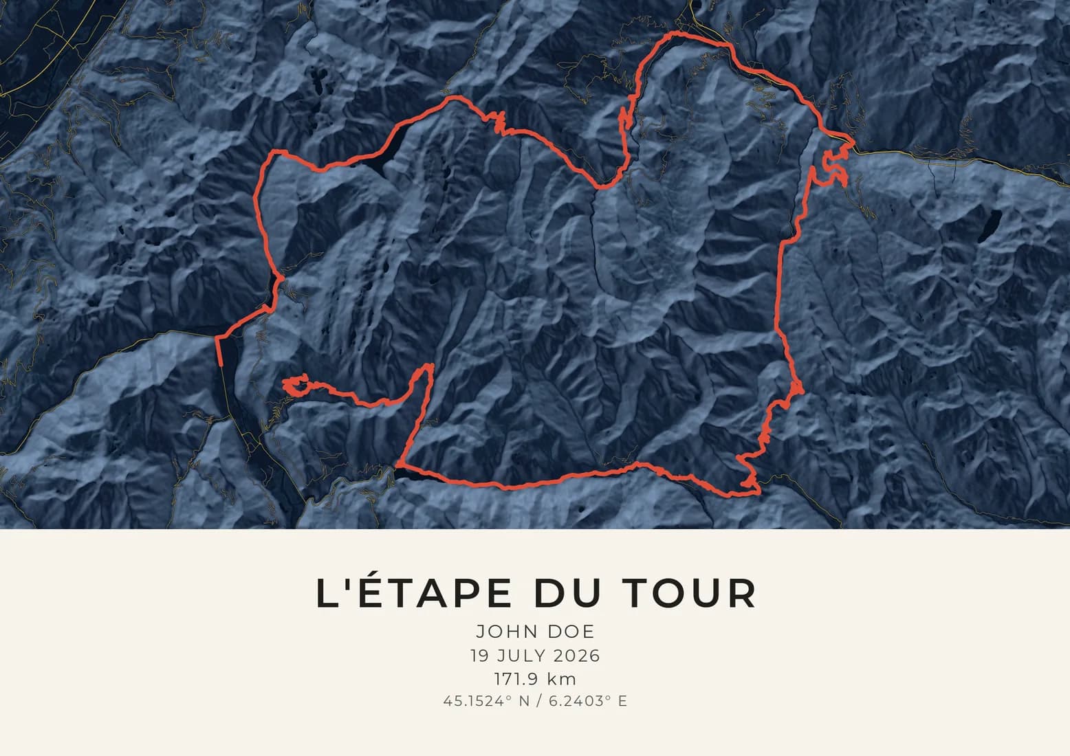
The 2026 course, 171.9 km, from Alpe d'Huez, France.
- Styles
- 19 colourwaysto choose from
- 300 DPIsharp at every size
- Price
- From £24.95delivered free
- Paper
- 240 gsmsmooth fine-art paper
The 2026 course is already drawn on the map, with the distance beneath it. Add your name and your finishing time, choose a style, and preview the finished artwork before you buy. Prices from £24.95, and delivery is free.
The amateurs rode the Tour's penultimate stage six days before the professionals: three great Alpine cols, then the back door into Alpe d'Huez over the little-used Col de Sarenne.
The 2026 Étape left Le Bourg-d'Oisans in waves from half past six, rolling north along the valley floor towards Allemond before the road tilts up for the Col de la Croix de Fer. It is a long climb rather than a savage one, broken by short descents and passing the Grand'Maison reservoir, and it tops out at 2,067 metres. From the summit the route plunges down the Arvan valley to Saint-Jean-de-Maurienne, then runs up the Maurienne to Saint-Michel, where the Télégraphe begins. The Télégraphe is wooded and regular, a climb to settle into, and it ends at 1,566 metres above a short drop into Valloire.
Valloire is where the real reckoning starts. The Galibier climbs out of the village through open pasture, the trees giving way to scree, and the final kilometres steepen towards the summit at 2,642 metres, the roof of the day. Riders spend a long time above 2,000 metres here, in thin air, and the descent past the Col du Lautaret and down the Romanche gorge is fast and long enough to chill tired legs. Beside the Lac du Chambon the route leaves the main road and turns uphill again, through the hamlets on the east side of the massif, towards the Col de Sarenne.
Sarenne was a deliberate choice. It is rarely raced, its road narrow and scarred, and it climbs to 1,999 metres across bare mountainside with no shade from the afternoon sun. Its hardest ramps come near the top, when there is least left to give. From the summit the road crosses the high ground to the edge of the resort and joins the classic Alpe d'Huez road only for its final few kilometres to the finish. Leaving out the famous hairpins below had a practical upside: finishers could ride all 21 of them on the way back down to Le Bourg-d'Oisans.
Questions
Does this route climb the 21 bends of Alpe d'Huez?
Only the very top of the climb. The 2026 route arrived over the Col de Sarenne from the east and joined the classic road for its last few kilometres, so most of the hairpins were the way back down after the finish.
How does this route relate to the Tour de France?
It is the course of stage 20 of the 2026 Tour, which the professionals raced on 25 July, six days after the amateurs rode it. The 2026 Étape was the event's 34th edition.
Can I add my finishing time?
Yes. The title and the line beneath it are yours to write, so your name, your finishing time and your club all fit. The 2026 course and its distance are drawn for you, and you see the finished artwork before you buy.
Is this an official L'Étape du Tour print?
No. Maps & Son is not affiliated with, or endorsed by, the organisers of the L'Étape du Tour; the name says which course is mapped. The course is drawn from a route file we use with permission.
Can I change the map?
Yes. The designer opens with the course drawn and the map framed around it. Move the map if you like, choose from 19 styles, and preview the finished artwork before you buy.
How much does a race route print cost?
Prints start at £24.95, printed on 240 gsm smooth fine-art paper, with delivery included to the UK and 25 other countries. Sold as A4, A3, A2 or A1 prints, unframed, at standard sizes so a ready-made frame will fit.
Other courses
Maps & Son is not affiliated with, or endorsed by, the organisers of the L'Étape du Tour. The course is drawn from a route file we use with permission. For the race itself, see the organisers' website.